
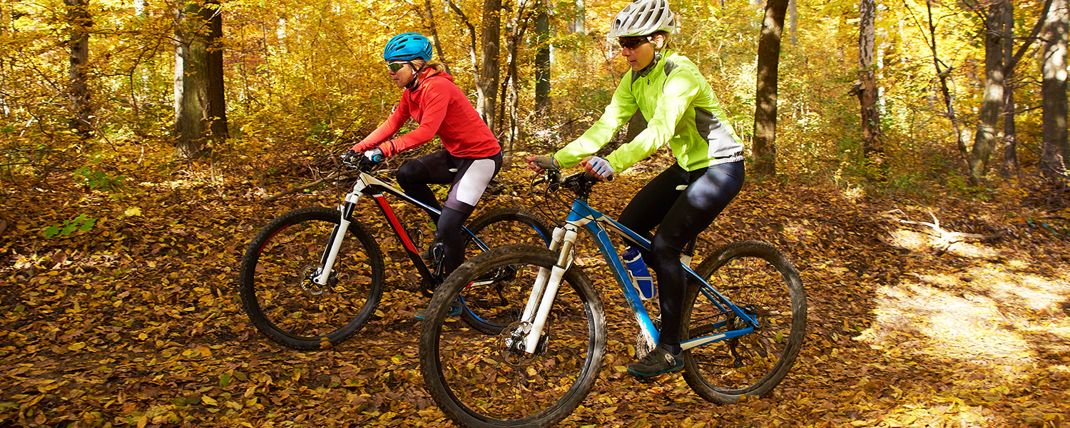
Mountain Biking In the VA Blue Ridge Mountains
Next to Shenandoah National Park
All of our 18 miles of trails can be used for biking
– from easy to killer tough and technical
Plus super hard technical mountain biking course touching Shenandoah national Park
From easy pushes for the whole family
to endless miles of tough technical climbing into the mountains on small trails.
Then even more, endless biking - connecting into Shenandoah National Park’s trails - need a park pass – which you can get here > https://www.nps.gov/shen/planyourvisit/fees.htm
Bike repairs – in Culpeper, 30 minutes’ drive.
Located in: Safeway Shopping Center
Address: 329b Southgate Shopping Center, Culpeper, VA 22701
Hours: Open ⋅ Closes 6PM
Phone: 540 317 5799
Easiest
Poplar Lodge and Beyond
Scenery: second growth forest out to Poplar and western property line. Back through grass meadow, with stop at stream side, farm pond.
Gravel road out right turn down to “Meadows” fishing pond, around pond, back to gravel road, right on road, left uphill to Poplar Lodge – continue into woods /or grass trail west on rough grass trail to end of our property line (obvious) trail turns right, gentle downhill, follow back as trail goes to right as you come down to Rose River, follow along as trail curves right - going down the river-side back to Kite House and Poplar Lodge back meadow. Play by stream at Kile House ford over the river that makes a small waterfall. Good fishing holes here and upriver.
Orchard and Robinson River
Blue Trail Markings and Arrows
Length: 3 to 5 miles, looping
Elevation gain: can push to 200 ft
Difficulty: Easy - Fun, Varied
Loop
Use the trails starting from the stables/farmyard and stay low, along double tracks out to Robinson River (a stream) and along, circle back to your left, then stay on the low shoulders of the mountain rising gently over you – Graves Mountain. Through orchard, along double tracks and trails to first level of the mountain’s shoulders, follow trails back following arrow signage.
Scenery: Orchards, meadows, crops, fallow fields, stream edge, uphill to hardwood Appalachia forest – second growth
 Easy flat to ever increasing hard uphill, but not technical as on a double track fire road
The Old Blue Ridge Turnpike - road to gravel double track to top out on Blue Ridge
Length: 9 miles to top – Skyline Drive at Fisher’s Gap at 3,548 ft.
Elevation gain: 2,858
Difficulty: Not technical but increasing slowly to hard climb with switch backs.
Out and Back or excursions on Stony Mountain Trail/Rapidan Fire Rd – traveling to Rapidan – right to Camp Hoover – left to Quaker Run and out to Rt 670. Left and back to Graves Mountain Farm.
This is the Old Blue Ridge Turnpike – the mid 1800’s toll road over the Blue Ridge.
Directions: west on our main street – the Old Blue Ridge Turnpike - and continue for 9 miles to top of Blue Ridge. The Rose River (just a small stream) is to your right as you climb up.
Scenery – Appalachia mixed forests, 2nd growth. River glimpses. Excellent mountain fly fishing in stream – steep access. Fishing? - License and Tout Stamp required – get at Market-Deli & Tackle .
Long views at top.
Please see full pdf map here >
Challenge course
No Dirt Bikes allowed except for one specific race for VCHSS – Hare challenge..
Hunting season – Nov 5 to Jan 7 for 2022-23- must get clearance from Lucky Graves to ensure that no known person is hunting in the area.
Be mindful of horse riders and step to the side.
 Yes, a real course laid out over our northern farm section.
Start at the back of the campground – go to back edge before you get to the Trout Pond section. Leading off to the left, you will find a trail with a mud/water trench as its appetizer.
Follow the trail and it will get you to our hard to conquer “Devil’s Backbone”.
Take care and let us know that you are heading out – call 303 877 9659 and leave a message or text for Eric, who will check back in with you.
There is, of course, no cell or WiFi coverage. Share with horses. Ride with mindfulness.
Please see full pdf map here >
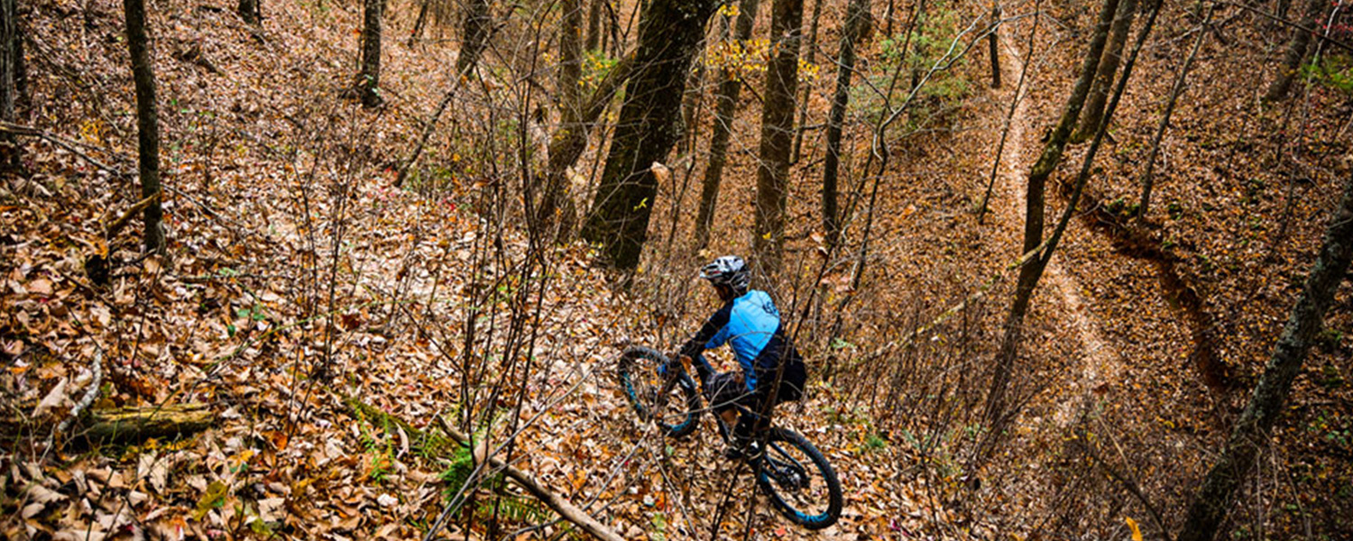
Short, Sharp, Hard and Technical
Highly technical very tough uphills and downhills
Green Trail Arrows
On Lodges’ side of farm (south side) , use Green Trails going up Doubletop Mountain
Entry Points: Behind Hilltop Lodge, West of Ridgecrest Lodge turn-around, large turnout space after pool on Poplar Rd – take immediate left trail.
Continue past Poplar Lodge and take immediate left trail up into forest.
Highly technical very tough uphills and downhills
Doubletop is 200 feet higher than “Old Rag” mountain.
Scenery – if you make it to the top of Doubletop, wide views. You will be the first whom we have heard of to make it up there. Celebrate and tell us please.